Virtual Tour, you can navigate through the image with your mouse.
PulvermaarNatural Swimming Pool and Hiking Paradise
Pulvermaar is the best-preserved Maar in the Eifel region: the crater is completely filled with water and surrounded by an almost closed tuff wall. It has the largest water surface and a depth of 74 meters, making it the deepest Maar in the Eifel region and one of the deepest lakes in Germany. But don't worry - the natural swimming pool has also been designed with non-swimmers and small children in mind.
Large sunbathing areas at the natural swimming pool, a 3-meter diving tower, rowing and pedal boat rental, all amidst beautiful scenery - you can spend several weeks at Pulvermaar. The fauna around Pulvermaar is also unique and special. An astonishing variety of waterfowl and dragonflies have impressed many visitors.
Information
- Coordinates: 50° 07' 53''N / 06° 55' 32''E
- Elevation: 418 meters above sea level
- Crater Diameter: 651 meters to 735 meters
- Crater Depth: 150 - 200 meters
- Crater Age: approximately 20,000 years
- Lake Surface Area: 377,000 square meters
- Current Lake Depth: approximately 74 meters
-
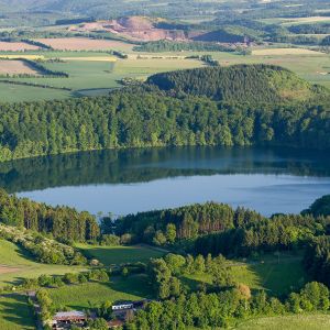
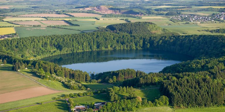
Das Pulvermaar von oben © Natur- und Geopark Vulkaneifel GmbH, Kappest
-
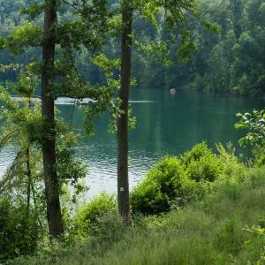
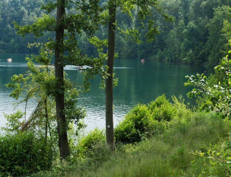
Tretboote auf dem Pulvermaar © Natur- und Geopark Vulkaneifel GmbH
Geology
The bedrock here consists of Lower Devonian shale, sandstone, and graywacke (Siegen Stage/Herdorf Formation), which are almost entirely covered by Maar tuffs. In the Tuffgrube Keil on the southwest edge of the Maar, the layers of the tuff wall stand 10 meters high. From the bottom up, the first eight meters consist of alternating layers of coarse-grained (especially shale fragments in various sizes) and fine-grained layers (ash). They were deposited by turbulent, about 200-degree hot ground currents (pyroclastic flows) directly after the explosion from the crater. The upper two meters consist of fine-grained, uniformly layered ashes that were later deposited from the air. In the south, directly on the lakeside path, you can see a basaltic dike in the wall. It probably forced its way through the Maar tephra, coming from Römerberg.
What Also Interests Non-Geologists
Pulvermaar belongs to a volcanic group with Strohner Määrchen and the 65-meter-high Römerberg. This volcanic group is characteristic of the landscape between Strohn and Gillenfeld. First, Strohner Määrchen was formed. Soon after, magma rose again at its northwest edge. This time, it did not encounter groundwater but was erupted as lava and piled up to form Römerberg, which is now 65 meters high. Strohner Määrchen at the foot of Römerberg is gradually filling up and is now a high moor with a unique flora and fauna.
How Pulvermaar Was Formed
Pulvermaar was the last link in the chain. In the northwest, a new volcanic vent formed, leading to the most powerful explosions of the volcanic group. Once again, magma encountered water underground and blasted out a cavity. The overlying rock layer collapsed, creating a crater that was originally 200 meters deep. Over time, the fragmented rock of the crater rim slid down and covered the extinct vent. Pulvermaar is still the deepest of all Eifel maars, measuring 74 meters today. Around the Maar, you can see what the volcano once ejected: its nearly 20-meter-thick wall of volcanic loose rocks (tephra) is still almost completely preserved and can be explored on a circular path.
Highlights Nearby
- Strohner Määrchen
- School Museum Immerath
- Immerather Maar
- Strotzbüscher Source
- Roman Grave
- Trautzberger Maar
- Lavabombe Strohn
- Volcano House Strohn
- Holzmaar
- Dürres Maar
- Hetsche Maar
- Sangweiher
- Mürmes
Pulvermaar is Stop 22 on the German Volcano Road.
Hiking Trails
around Pulvermaar
Here you will find a selection of hiking trails located in the immediate vicinity of Pulvermaar. The impressive landscape offers many opportunities. Spend beautiful days and a thoroughly enjoyable time here at lovely Pulvermaar.
-

MaareGlück
Rundweg um Schalkenmehren und die Dauner Maare, vorbei an der Sternwarte Hoher List
- Schwierigkeitsgrad:

- Strecke: 10,9 km -
- Dauer: 3,5 Std.
- Aufstieg: 320 hm -
- Abstieg: 320 hm
- Schwierigkeitsgrad:
-

Maare-Pfad
Von Schalkenmehren bis Lutzerath
- Schwierigkeitsgrad:

- Strecke: 34,7 km -
- Dauer: 12 Std.
- Aufstieg: 657 hm -
- Abstieg: 672 hm
- Schwierigkeitsgrad:
Guided Tours around Pulvermaar
Directions
Pulvermaar is signposted from Gillenfeld and on B 421. The signs lead to the Pulvermaar natural swimming pool.